Surface analysis software trusted by the professionals
Used by thousands of engineers, scientists and metrologists worldwide, MountainsMap® software is the gold standard in 2D and 3D surface texture analysis and measurement for use with profilometers and other surface measurement instruments.
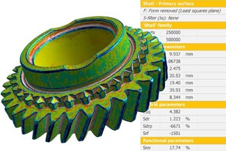
Visualize, correct and analyze profiles and surfaces – Filter roughness & waviness according to ISO 16610 – Calculate ISO profile and area parameters – Extract functional and metrological information from your data using advanced tools: Fourier analysis, particle analysis, step height, shape fitting, wavelet filter, fractal analysis etc. – Load, visualize and analyze freeform surfaces (shells)
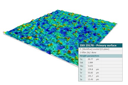
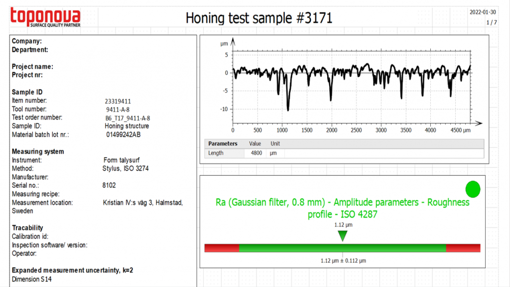
Perform surface roughness analyzes and calculate surface texture parameters according to ISO 25178, ISO 4287, ISO 13565, ISO 21920 and other national standards.
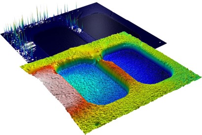
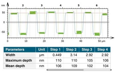
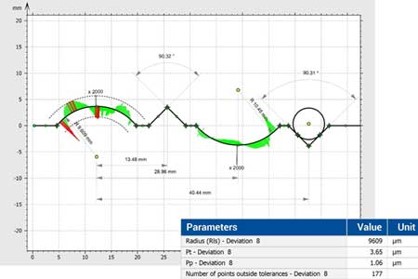
Effective and accurate analysis of surface geometry (distances, angles, surfaces of peaks and troughs, volumes of elevations and holes, step heights on surfaces and profiles, etc.)